-
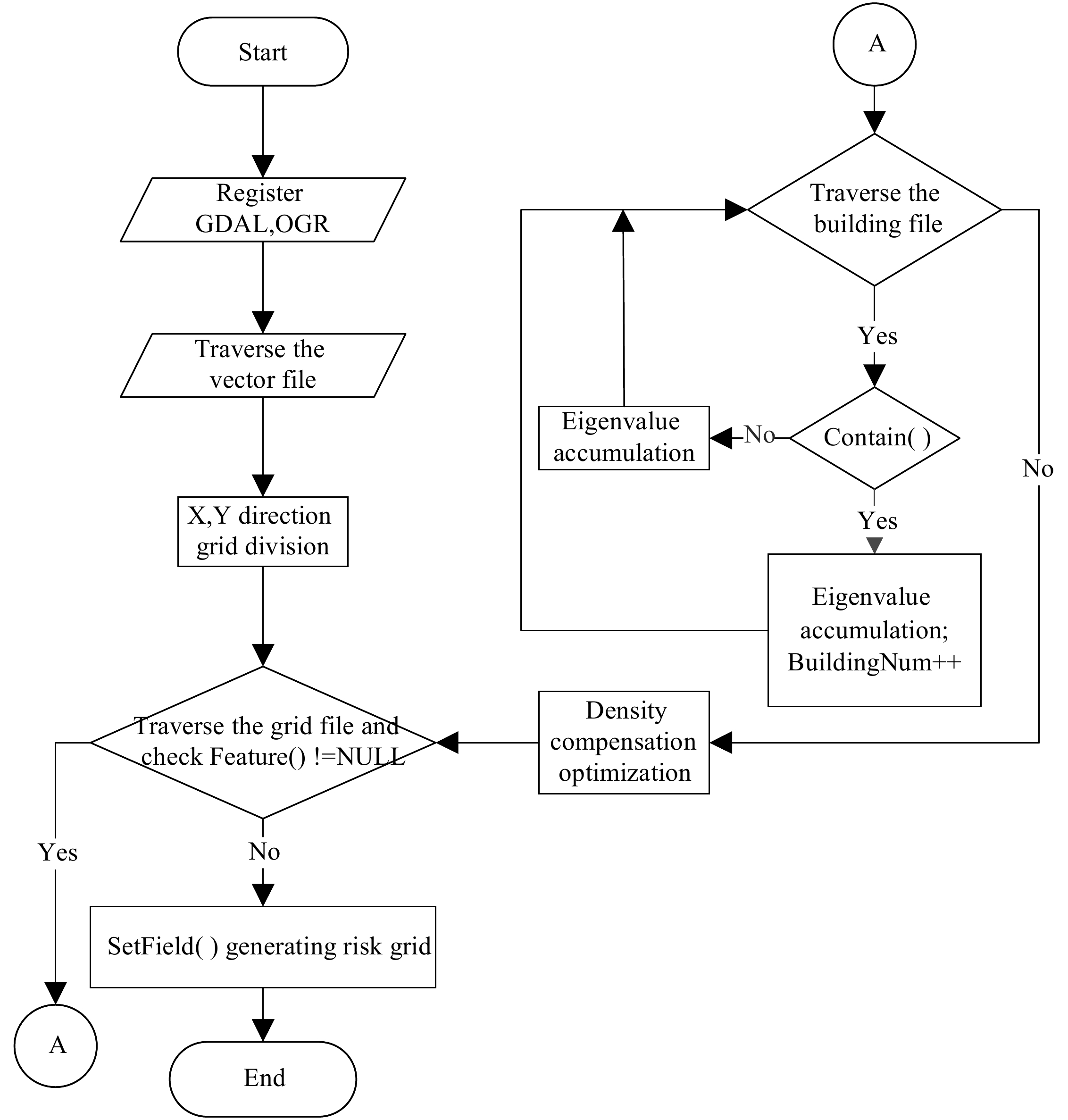
Figure 1.
Algorithm flowchart.
-
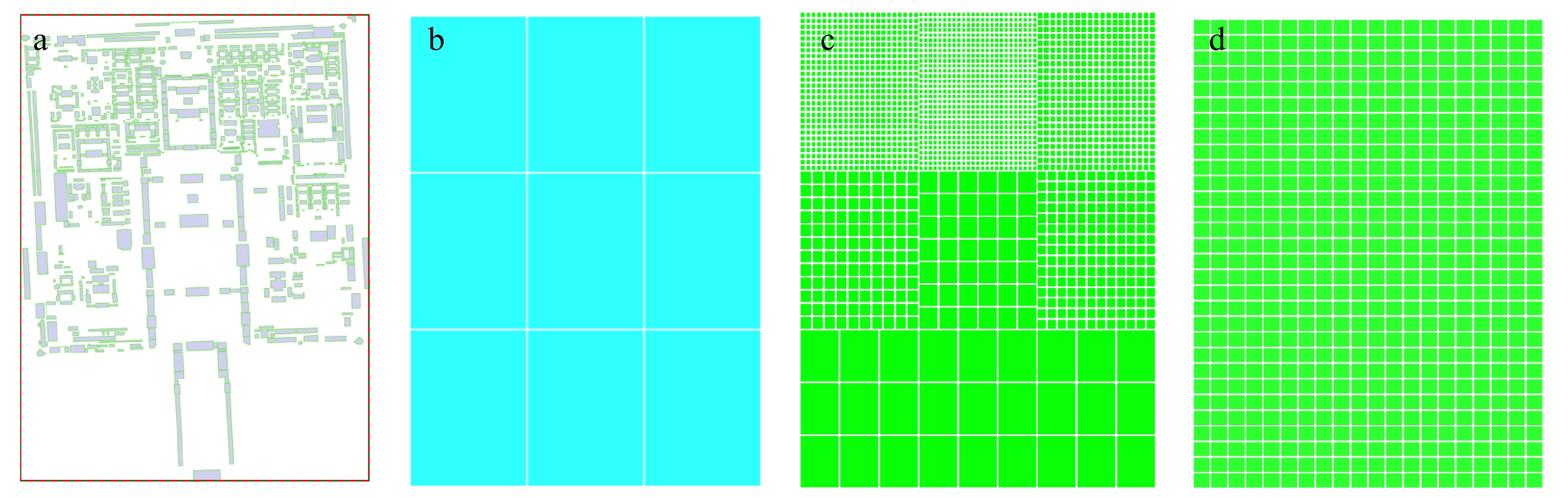
Figure 2.
Algorithm result graph. (a) the Imperial Palace City map, (b) 3 × 3 grouping search, (c) optimized inverse grid division, (d) equidistant grid division.
-
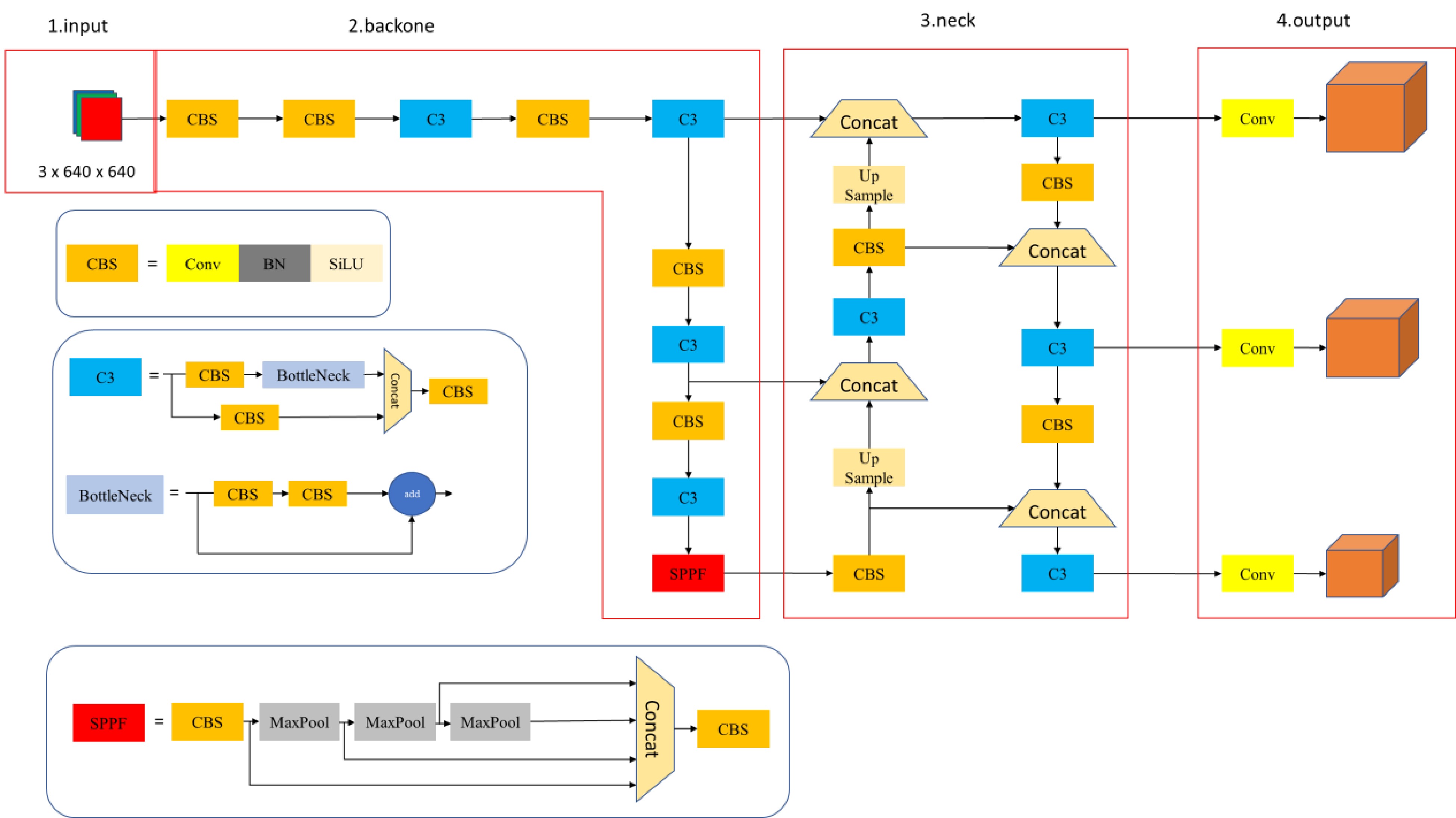
Figure 3.
YOLOv5s network architecture diagram.
-
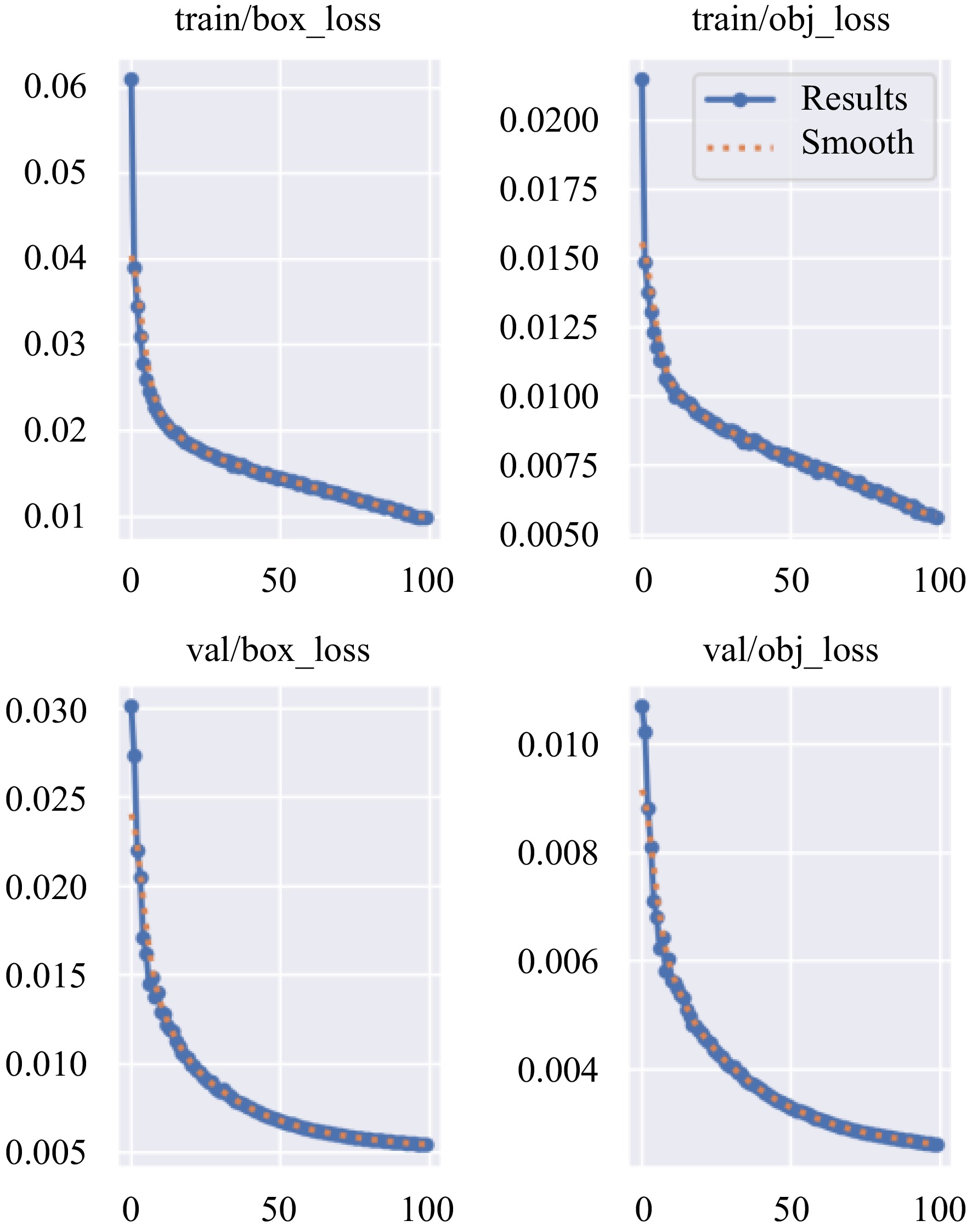
Figure 4.
Loss-epoch.
-
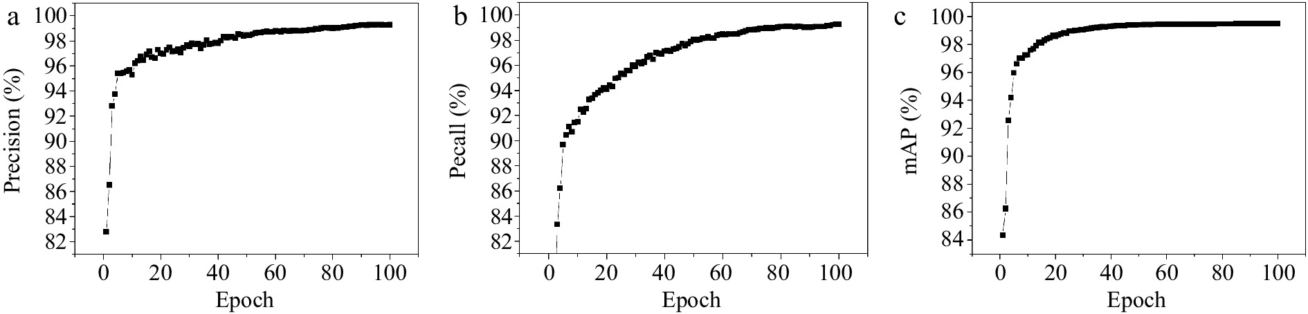
Figure 5.
(a) Precision, (b) recall, (c) mAP result.
-
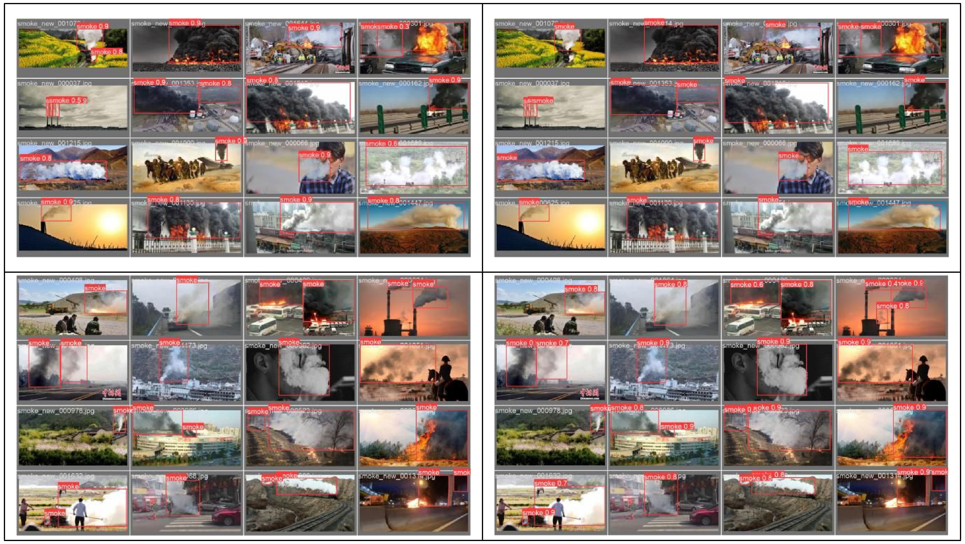
Figure 6.
YOLOv5s detection results.
-
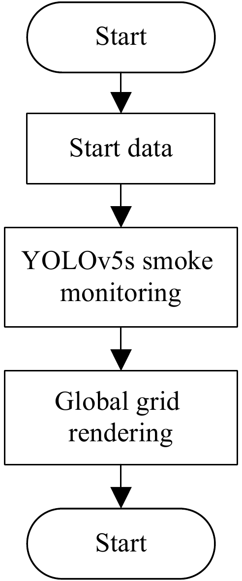
Figure 7.
Algorithm chart.
-
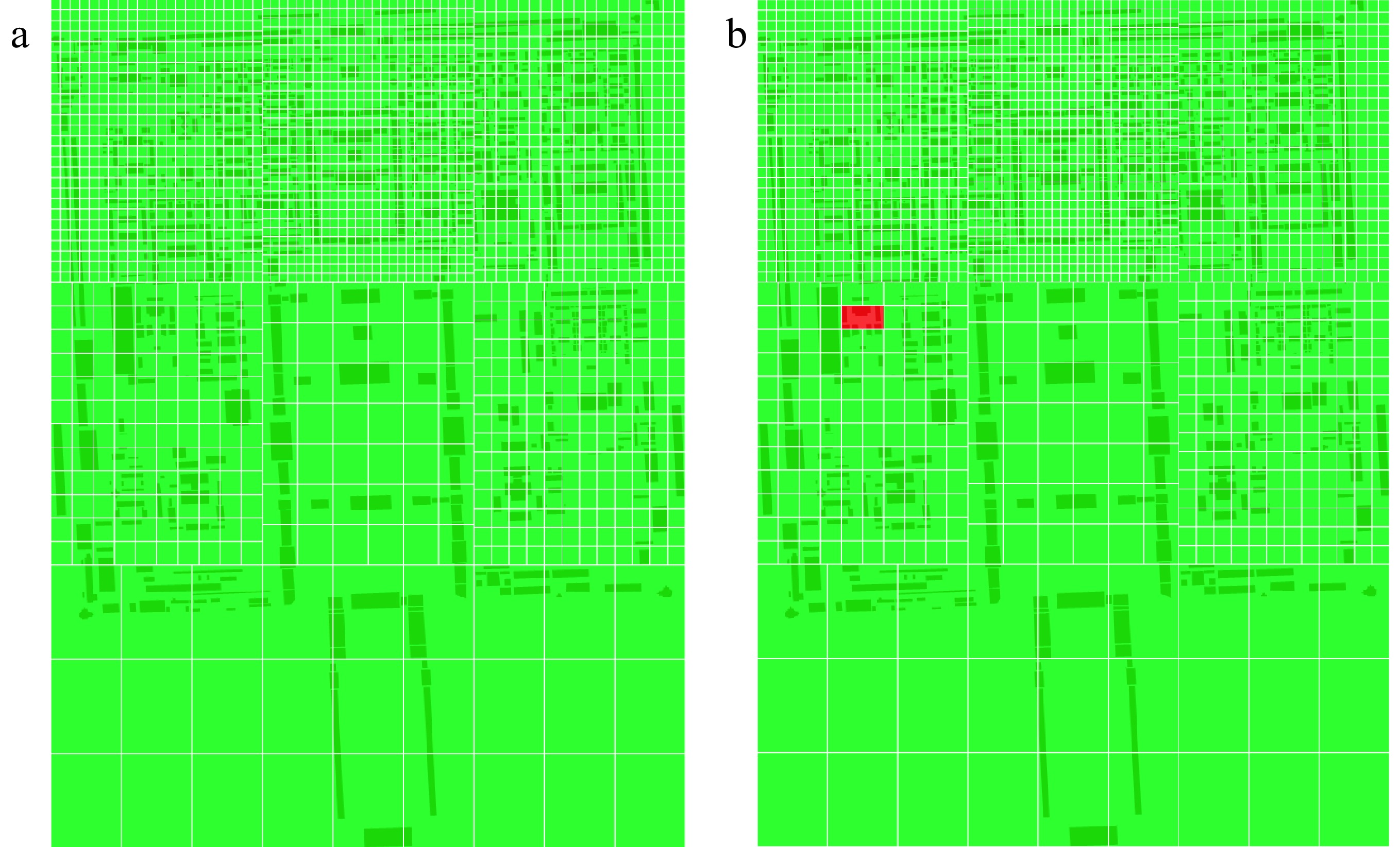
Figure 8.
Algorithm result graph.
-
File format File attribute information .shp Store geometric shape data of geographic features such as points, lines, and surfaces, including coordinates, shape types, etc. .shx Spatial index files, accelerating search and access to geographic features from. shp files .dbf Store attribute data of geographic features in table form, including field names, field types, etc. .prj Store projection information of geographic data and describe a reference system for geographic coordinates. Table 1.
Output file format.
Figures
(8)
Tables
(1)